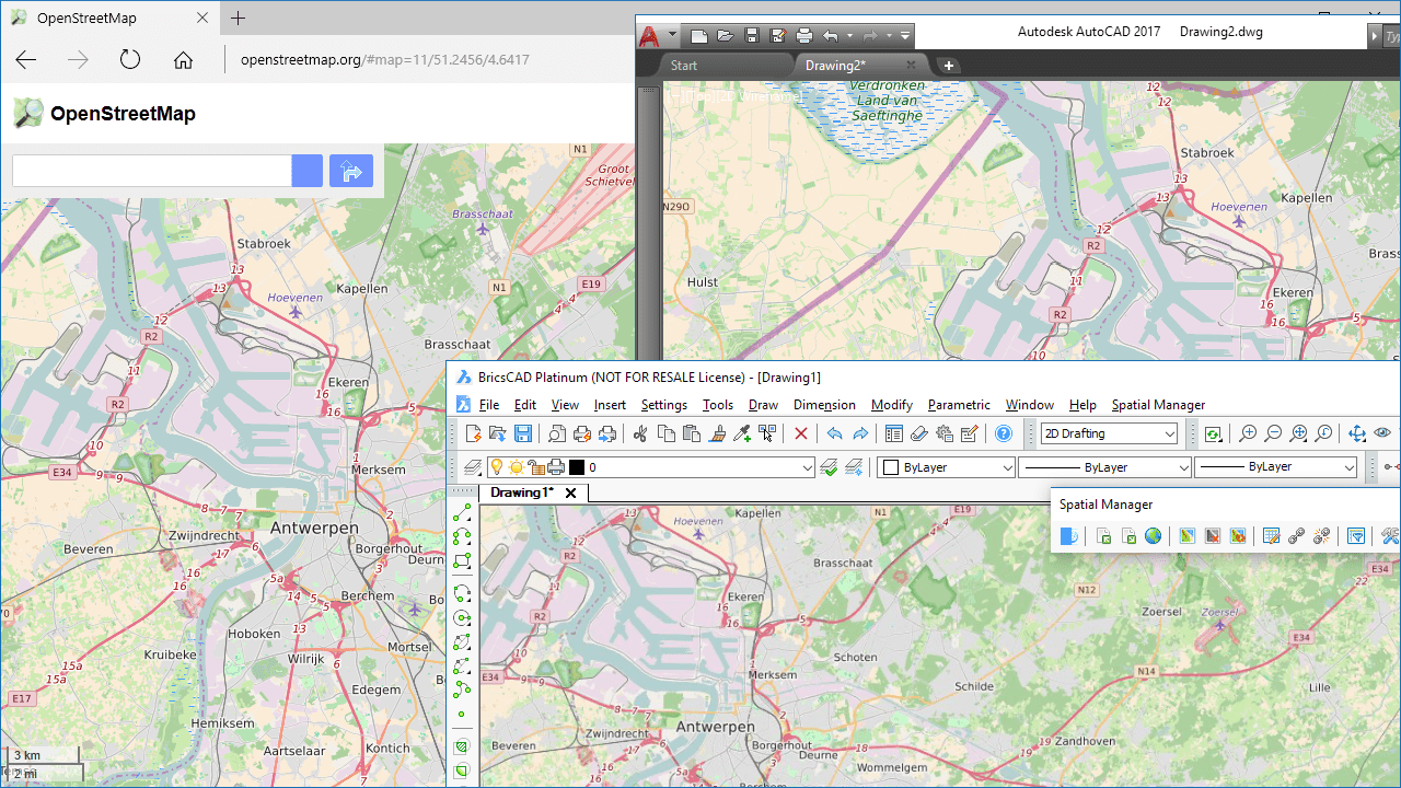
Although the ‘Spatial Manager’ applications include many Background map models that can be chosen directly when you need to display them, you may be interested in access to many others maps available around the world. The “classic look” map of OpenStreetMap cannot be freely distributed within an app but you will see in this example how it can be configured in ‘Spatial Manager’
Videos: AutoCAD / BricsCAD
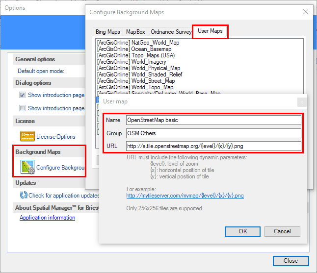
‘Spatial Manager for AutoCAD’ and ‘Spatial Manager for BricsCAD’ allow you to set up any “User map” in a simple and fast way
You only need to know the appropriate URL to access the raster “Tiles” through any available Web Map Tile Service (WMTS). This URL must include the following dynamic parameters:
{level}: level of zoom
{x}: horizontal position of tile
{y}: vertical position of tile
For example: http://mytileserver.com/mymap/{level}/{x}/{y}.png
In the case at hand, the following is the URL that you need to enter:
http://a.tile.openstreetmap.org/{level}/{x}/{y}.png
As you will see in the parameters window, you can also assign a Name to the new map and include it into a new or an existing Group of user maps