‘Spatial Manager’ for CAD applications (AutoCAD, BricsCAD and ZWCAD) will enable you to perform territorial analysis processes based on the geographic objects by using selection tools and Properties of the graphic objects themselves. For a great amount of these processes you will not need to generate topologies or calculate complex topological operations
Related videos: AutoCAD / BricsCAD / ZWCAD
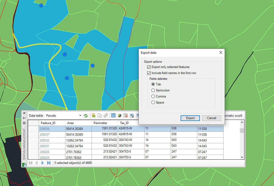
Parcels road-crossing analysis
Check out in the above videos how the advanced selection methods in your CAD application along with ‘Spatial Manager’ import, export and data management functionalities can provide you with powerful geospatial analysis tools
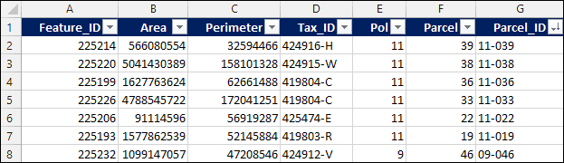
Affected parcels table
If you are a ‘Spatial Manager Desktop’ user, you will also find included tools for the geospatial analysis of the elements of a map. Take a look at this other Blog entry
Learn more about data management and queries in ‘Spatial Manager’:
Note: Some features in the videos are available in the Standard and/or Professional editions only


