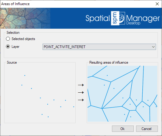
Gera polígonos que representam áreas de influência em torno dos pontos selecionados com base na proximidade. Esses polígonos, conhecidos como diagramas de Voronoi, definem regiões mais próximas a cada ponto da seleção.
Cada polígono resultante herda os dados de atributos do seu ponto correspondente.
Essa funcionalidade é útil para tarefas de análise espacial, como identificar zonas de cobertura de farmácias dentro de um município ou estudos similares baseados em proximidade.
Mapflow is a cutting-edge geospatial intelligence platform leveraging artificial intelligence to automatically identify and classify geographic objects—such as buildings, roads, and forested areas—within satellite and aerial imagery.... more
In this third example on spatial analysis using Overlays in ‘Spatial Manager’ we will apply the “Intersect” operator. This operator determines the geometries that overlap in the Source and Overlay... more
In this second post dealing with Overlays in ‘Spatial Manager’, we will analyze another interesting operator (Clip), which creates objects from the areas of the Source that overlap with the... more
This post starts a series dedicated to one of the most powerful geometric and data-driven analysis tools included in ‘Spatial Manager’: the Overlay command. There are several operators to apply... more