Calculateur de champs dans GstarCAD
Calculez dans GstarCAD des expressions simples ou complexes à l'aide d'opérateurs et de fonctions qui peuvent être appliqués à des valeurs de champs de tables et/ou à des valeurs constantes
Des fonctions géométriques telles que l'aire ou le périmètre sont également disponibles.
Découvrez tout le potentiel de cet ensemble d’outils conçu pour améliorer l’intégration et l’édition des données SIG dans GstarCAD.
Opérateurs et fonctions

Fonctions géométriques
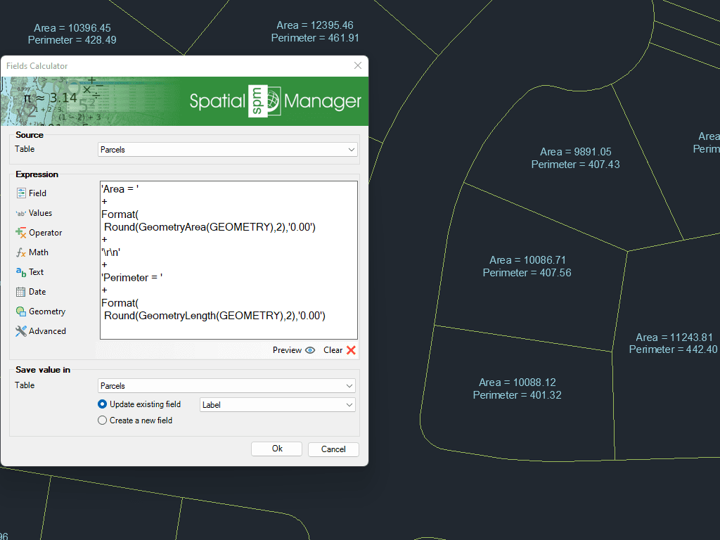
Expressions avancées


Tableau de données
Amélioration en V10Les tables de données fournissent la structure pour associer des informations aux objets du dessin. Elles peuvent être attachées automatiquement lors de l’importation ou créées manuellement en ajoutant des champs de différents types de données.
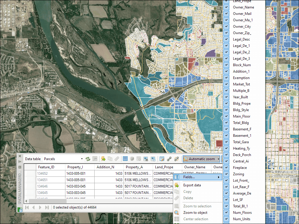
La palette de la Grille de Données dans GstarCAD vous permet de visualiser, éditer, etc. les données des objets dans n'importe quelle table du dessin. Vous pouvez également sélectionner des objets dans la Grille de Données, exporter des données à partir de tables, etc.
* Sont disponible que dans le édition Professional
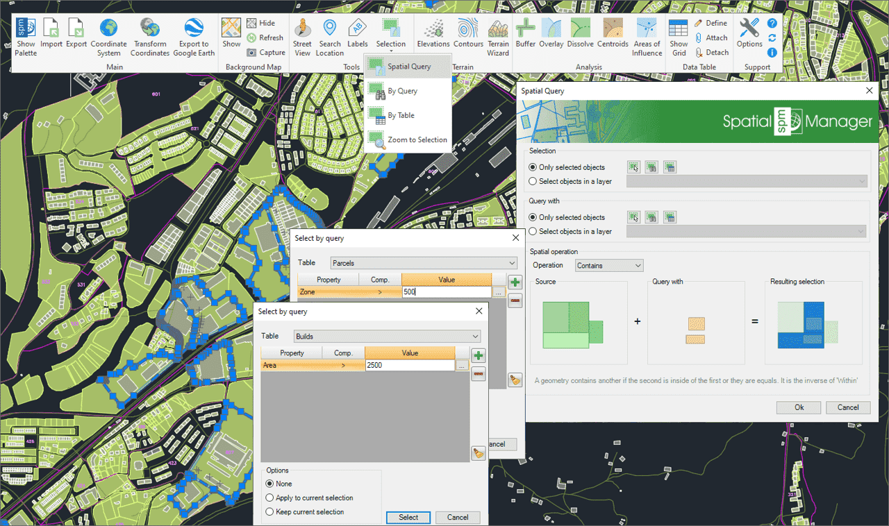
Utilisez des requêtes pour sélectionner des objets du dessin en fonction des conditions d’attributs
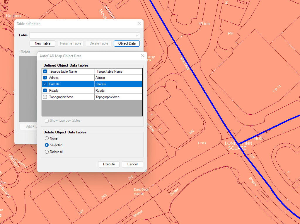
Importez et convertissez les données du format AutoCAD Map en Données Étendues (EDD) de GstarCAD.

Intégrer vos propres fonctions LISP à l'aide de l'API (Application Programming Interface) pour créer des opérations personnalisées liées aux données
* Sont disponible que dans le édition Professional

Generates a CAD table directly in the drawing using the data linked to the objects. Users can define which fields will appear as columns, making the table highly customizable. In... more

Multiple tables with various fields can be simultaneously attached to objects. This capability offers a highly organized and structured method for managing data. This approach allows the use of multiple... more

Reverse geocoding is the process of converting geographic coordinates (latitude and longitude) into a human-readable address or place name. This is typically done using a reverse geocoding service or API,... more

GML (Geography Markup Language) is an XML-based language created by the Open Geospatial Consortium (OGC) for modeling, transporting, and storing geographic information. GML files classify elements by type, and Spatial... more