Abfragen Ihrer Geo-Daten
Abfrage der Auswahlen, indem Sie geometrische Operationen ausführen, um Elemente zu lokalisieren, die unter bestimmten Bedingungen andere Elemente stören (schneidet, berührt, innerhalb, enthält, zerlegt, überlappt oder kreuzt)
Abfragen Ihrer Geo-Daten
Dies hilft dabei, Objekte zu identifizieren und zu analysieren, die bestimmte räumliche Bedingungen in Ihrer Zeichnung erfüllen.
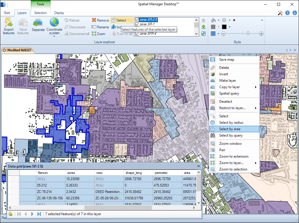
Mehrere grafische Auswahlmethoden und Ebenenauswahl. Hinzufügen oder Entfernen von Elementen zu den Auswahlen mithilfe mehrerer Methoden. Schnelle Filterung der Auswahl nach Ebene
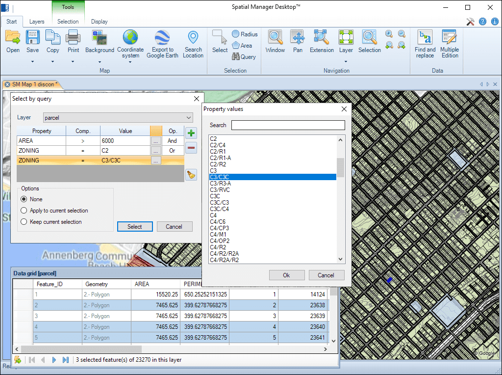
Einzelne oder komplexe Auswahlen per Abfrage. Datenrasterauswahl. Datenraster-Navigationstools durch die Auswahlen. Erweiterte Informationen für die Auswahlen im Datenraster
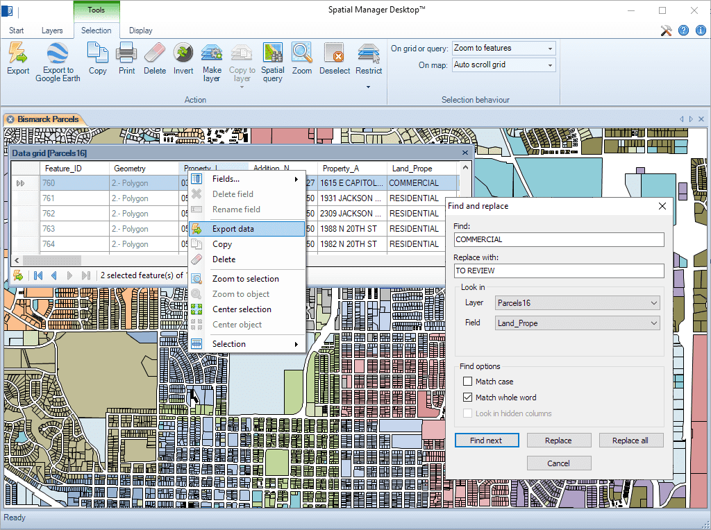
Suchen (und Ersetzen) von Daten im Datenraster, die auf die Werte von Feldern in Ebenen angewendet werden. Die Funktion „Alle ersetzen“ ist enthalten. Berichte einschließlich der geänderten Werte und Felder
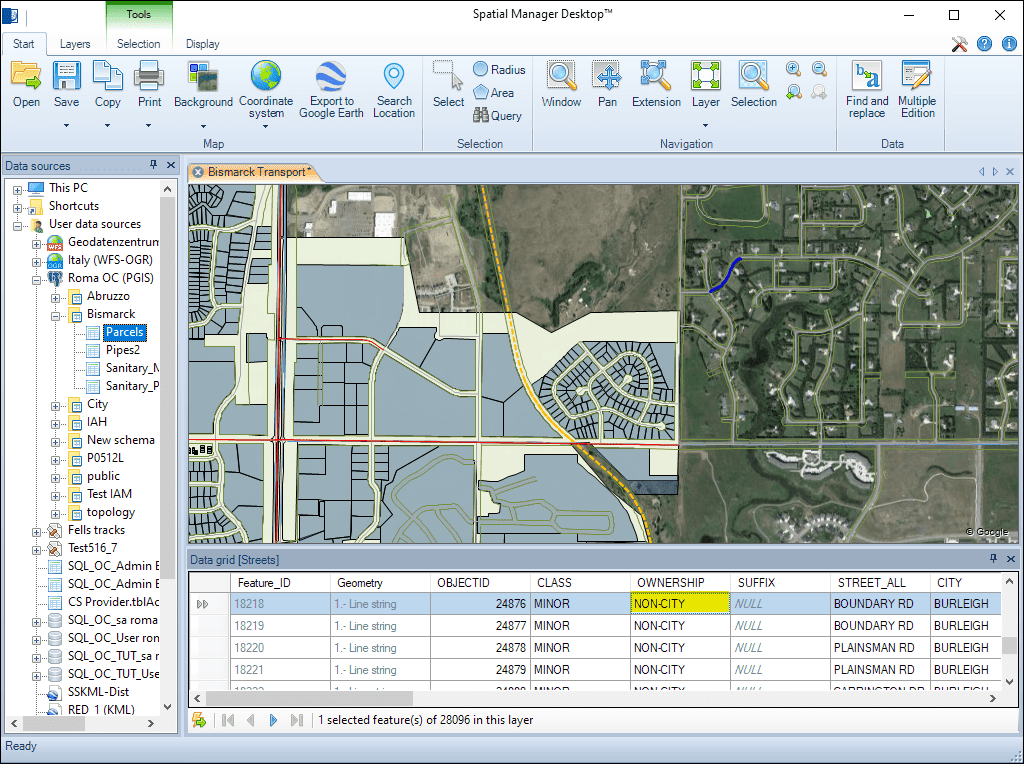
Schnelle Bearbeitung des Werts jedes beliebigen Ebenenfelds im Datenraster
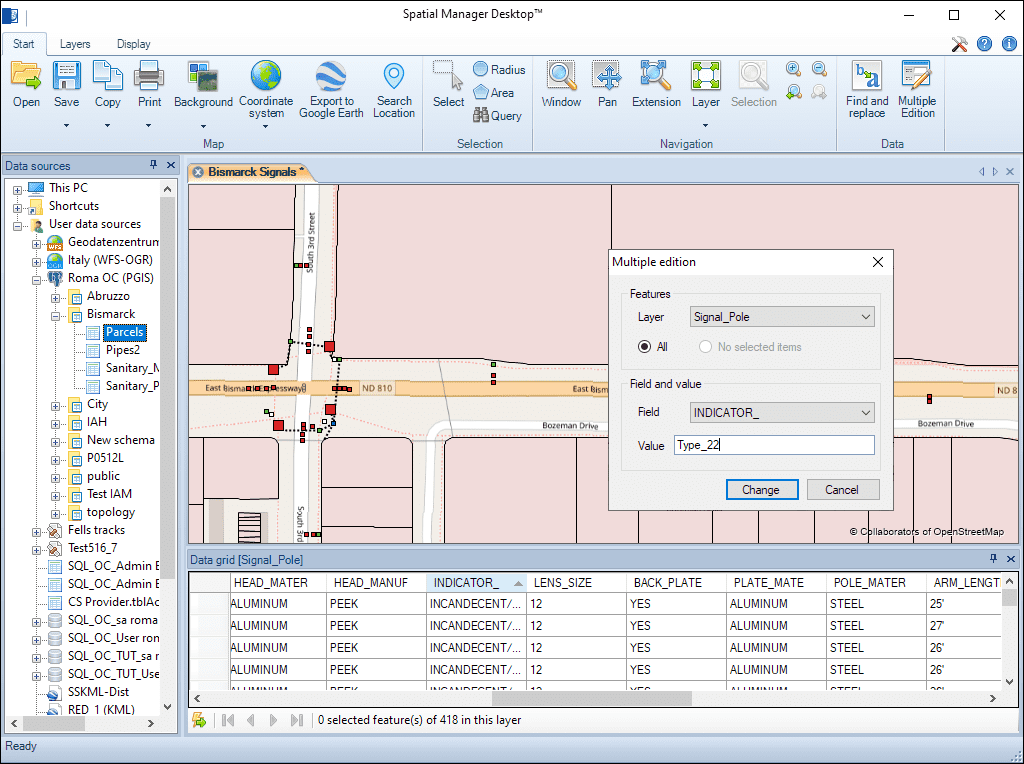
Bearbeiten des Werts eines beliebigen Ebenenfeldes im Datenraster für mehr als ein Element gleichzeitig
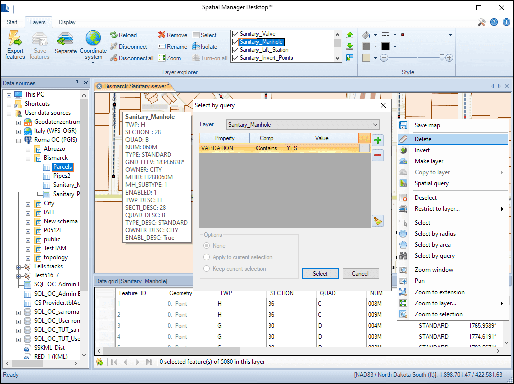
Löschen von Elementen, die in einer beliebigen, bearbeitbaren Ebene in der Karte ausgewählt wurden
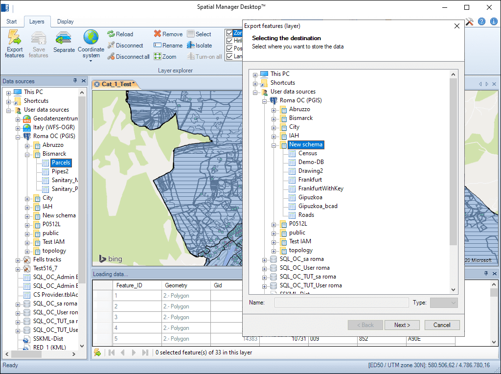
Jede externe Ebene kann gespeichert werden, um ihre ursprüngliche Quelldatentabelle zu ersetzen. Interne Ebenen, z. B. neue oder getrennte Ebenen, können in eine Tabelle in eine beliebige Geo-Datei, einen Datenbankserver oder eine räumliche Verbindung exportiert werden

Reverse geocoding is the process of converting geographic coordinates (latitude and longitude) into a human-readable address or place name. This is typically done using a reverse geocoding service or API,... more

GML (Geography Markup Language) is an XML-based language created by the Open Geospatial Consortium (OGC) for modeling, transporting, and storing geographic information. GML files classify elements by type, and Spatial... more

Perform calculations on new or existing field values by applying a wide range of operators and functions, such as arithmetic operations (addition, subtraction, multiplication, division), mathematical functions (square root, logarithms,... more

Direct geocoding is the process of converting an address or a place name into geographic coordinates (latitude and longitude). This is typically done using a geocoding service or API which... more