Centróides de polígonos em AutoCAD
Permite gerar Centróides polígonos (objetos tipo Ponto) adoptando os dados dos polígonos, ou adicionar dados dos Centróides aos polígonos que os contêm
Centróides de polígonos
- Gerar centróides: Criar pontos de centróides para os polígonos selecionados, anexando automaticamente os dados de atributos dos polígonos aos novos objetos centróides.
- Capturar dados dos centróides: Transferir dados dos pontos centróides selecionados para cópias dos polígonos que os contêm. Isso permite enriquecer os atributos dos polígonos com informações derivadas de seus centróides.
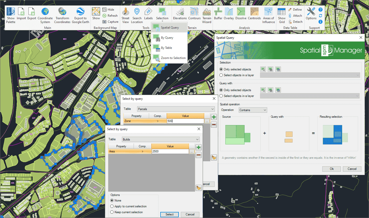
Seleção de objetos no desenho de acordo com o resultado de consultas espaciais avançadas simples ou compostas, utilizando as seguintes operações geométricas.
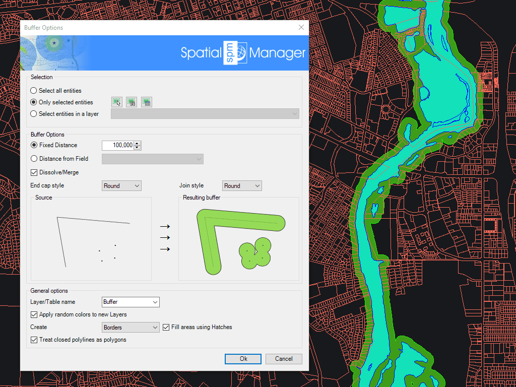
Geração de polígonos Buffer em torno de objetos pontuais, lineares ou poligonais
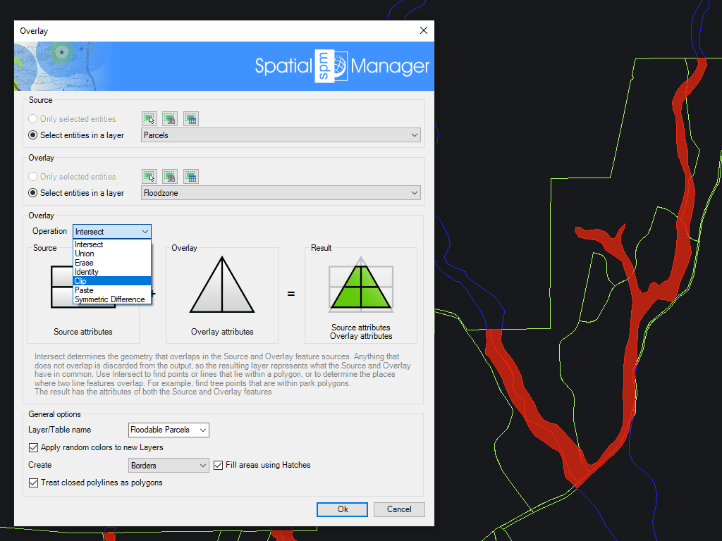
Permite criar novos elementos com base em operações geométricas e de dados entre dois grupos de elementos existentes. Estas operações são: Intersecção, União, Apagar, Identidad,e Recortar, Colar e Diferença simétrica.
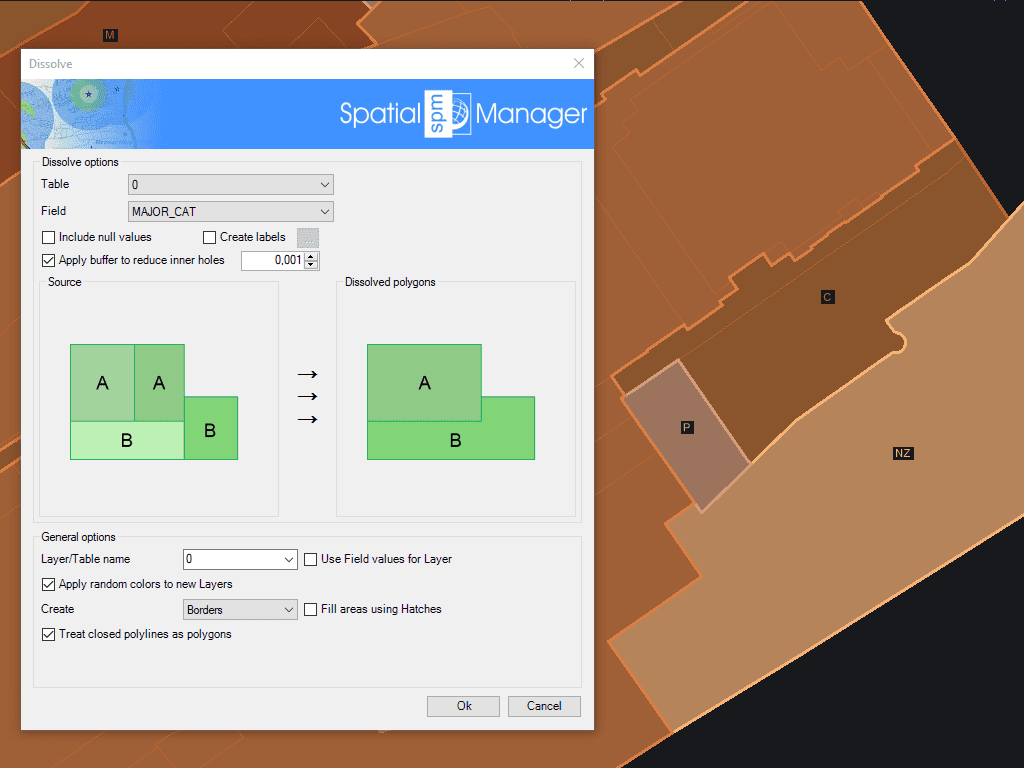
Geração de novos polígonos com base no agrupamento de outros polígonos adjacentes com alguns dados comuns
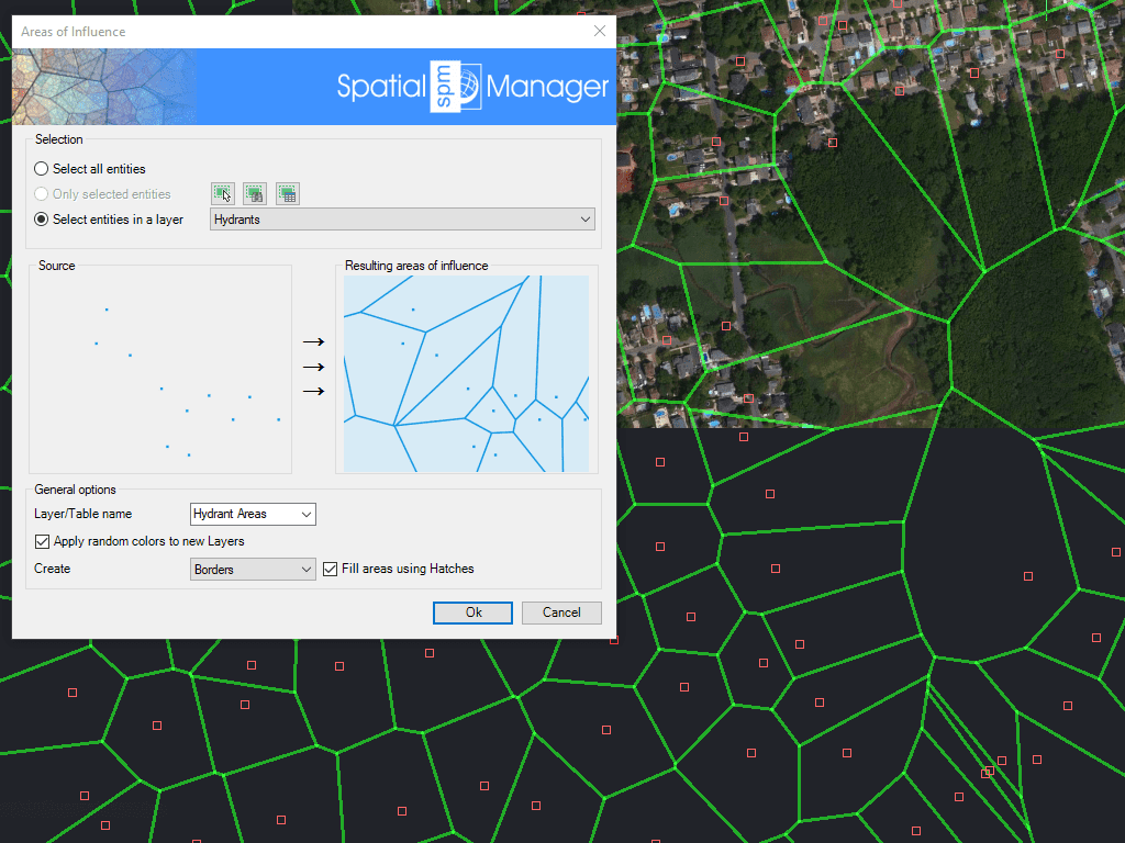
Cria polígonos definidos pelos conjuntos de pontos mais próximos a cada ponto de uma seleção no mapa (diagramas de Voronoi)

Spatial Manager creates buffer polygons around points to show the area within a chosen distance of each location. This is useful for showing a facility’s service area or finding objects... more

Mapflow is a cutting-edge geospatial intelligence platform leveraging artificial intelligence to automatically identify and classify geographic objects–such as buildings, roads, and forested areas–within satellite and aerial imagery. Mapflow enables high-precision... more

In this third example on spatial analysis using Overlays in ‘Spatial Manager’ we will apply the “Intersect” operator. This operator determines the geometries that overlap in the Source and Overlay... more

In this second post dealing with Overlays in ‘Spatial Manager’, we will analyze another interesting operator (Clip), which creates objects from the areas of the Source that overlap with the... more