Queries alfanuméricas
Seleções simples ou complexas por query. Seleções na grade de dados. Ferramentas de navegação na grade de dados através das seleções. Informações avançadas para seleção da grade de dados
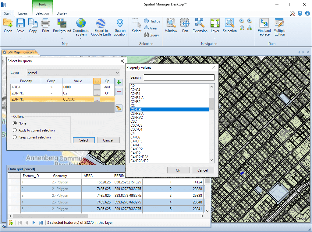
Queries alfanuméricas
Gerencie e navegue por essas seleções de forma eficiente na grade de dados, que oferece informações avançadas e ferramentas para revisar e editar os dados selecionados de forma fluida.
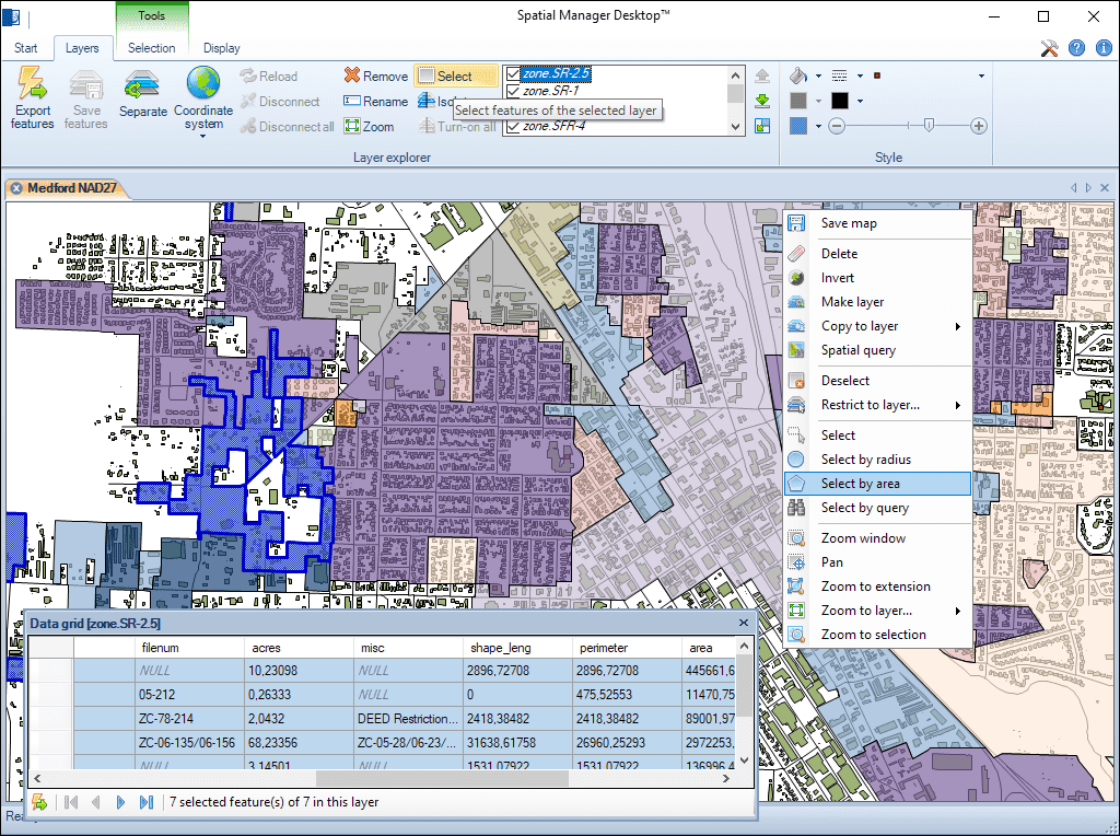
Múltiplos métodos de seleção gráfica e seleção por camadas. Adicione ou remova elementos a seleções usando múltiplos métodos. Filtre rapidamente as seleções por camada
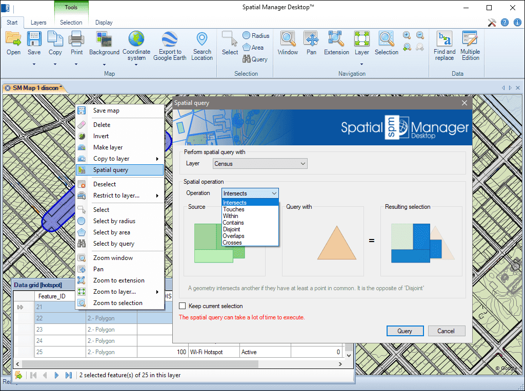
Query de seleções realizando operações geométricas para localizar elementos que interferem com outros elementos sob certas condições (interseções, tocar, dentro de, contém, disjunções, sobreposições ou cruzamentos)
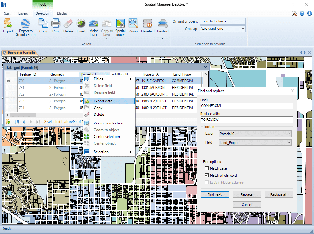
Encontrar (e substituir) os dados na grade de dados aplicada aos valores de campo nas camadas. A funcionalidade "Substituir tudo" está incluída. Informes incluindo valores e campos modificados
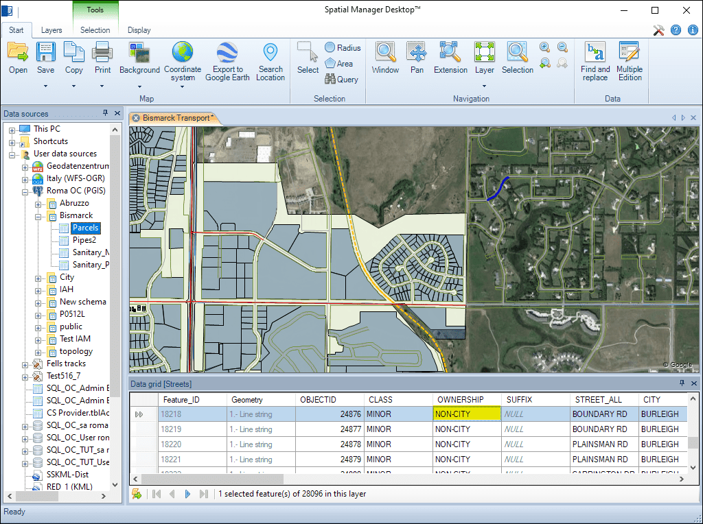
Altere rapidamente o valor de qualquer campo das camadas na grade de dados
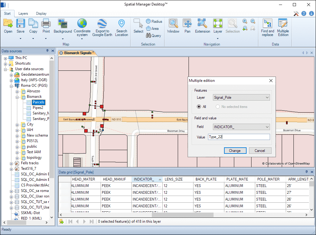
Altere o valor de qualquer campo da camada na grade de dados para mais de um elemento simultaneamente
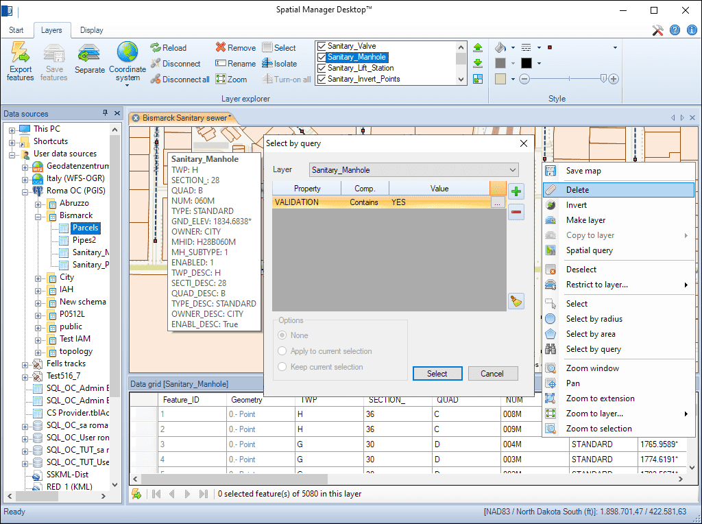
Elimine elementos selecionados em qualquer camada editável do mapa
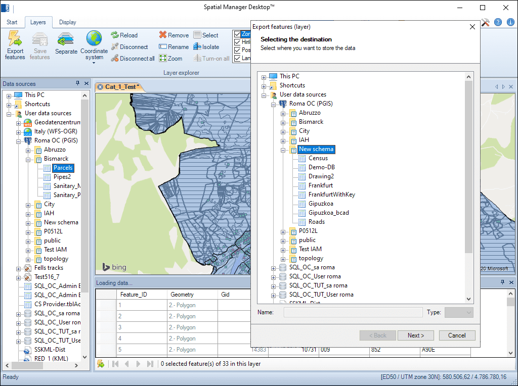
Qualquer camada externa pode ser salva para substituir a tabela de dados original. Camadas internas, tais como camadas novas ou desconectadas, podem ser exportadas para uma tabela em qualquer arquivo espacial, servidor de banco de dados ou conexão espacial

Reverse geocoding is the process of converting geographic coordinates (latitude and longitude) into a human-readable address or place name. This is typically done using a reverse geocoding service or API,... more

GML (Geography Markup Language) is an XML-based language created by the Open Geospatial Consortium (OGC) for modeling, transporting, and storing geographic information. GML files classify elements by type, and Spatial... more

Perform calculations on new or existing field values by applying a wide range of operators and functions, such as arithmetic operations (addition, subtraction, multiplication, division), mathematical functions (square root, logarithms,... more

Direct geocoding is the process of converting an address or a place name into geographic coordinates (latitude and longitude). This is typically done using a geocoding service or API which... more