Datentabelle in GstarCAD
Verbessert in V10Datentabellen bieten die Struktur zur Verknüpfung von Informationen mit Zeichnungsobjekten. Sie können während des Imports automatisch angehängt oder manuell durch Hinzufügen von Feldern verschiedener Datentypen erstellt werden.
Entdecken Sie das volle Potenzial dieses Werkzeugsatzes, der entwickelt wurde, um die Integration und Bearbeitung von GIS-Daten in GstarCAD zu verbessern.
Datenstruktur
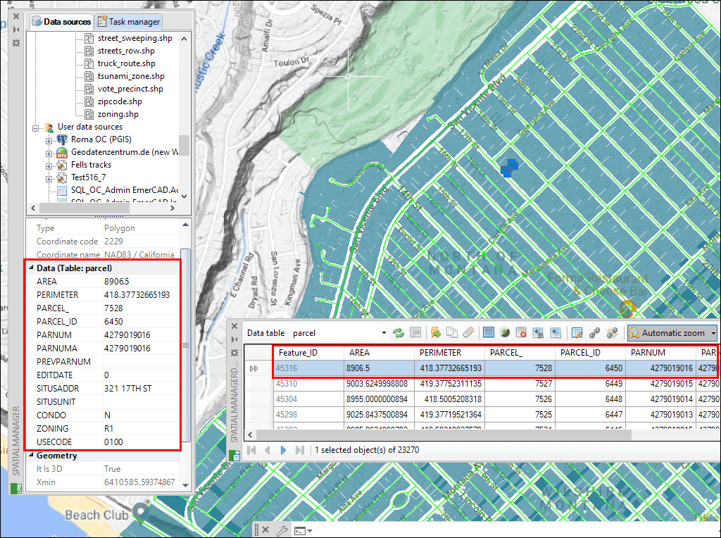
Tabellenausgabe

Objektmanagement

Mehrere Tabellen verknüpfen
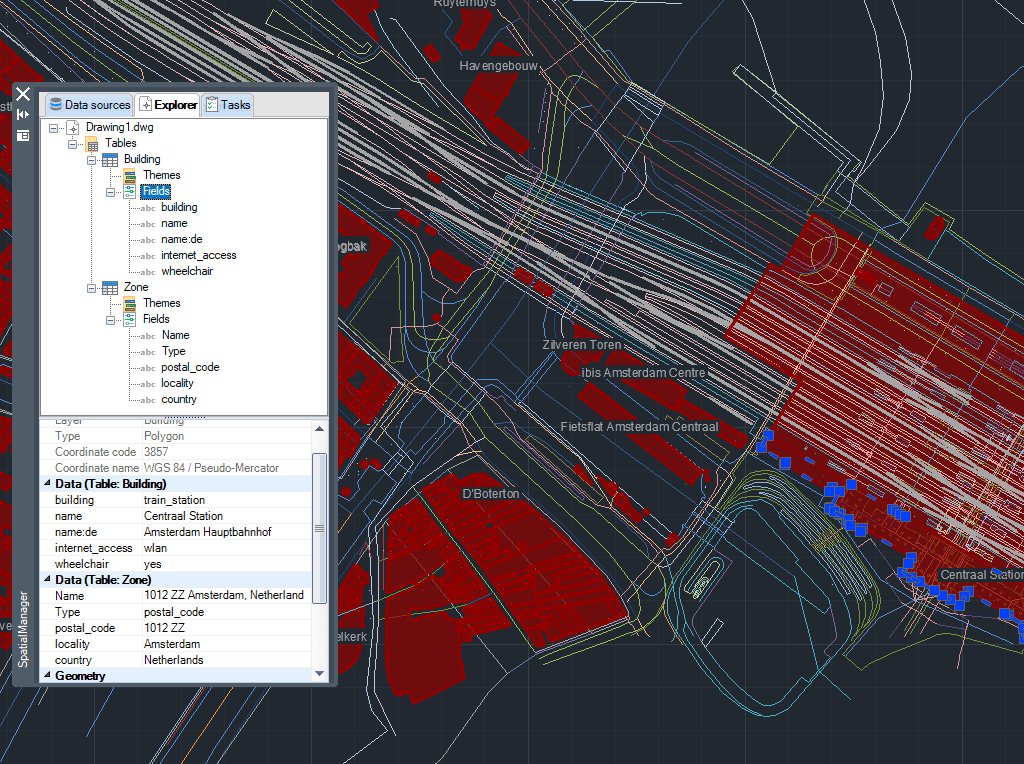
Tabelle zeichnen
Neu in V10* Nur in der Professional Edition verfügbar

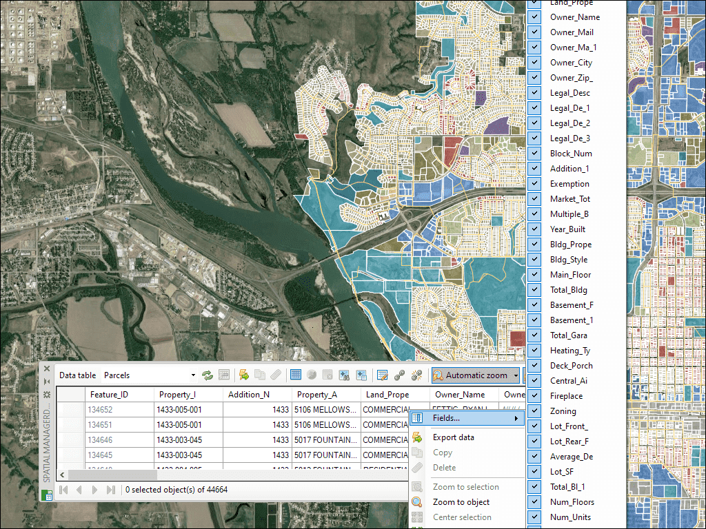
Mit der Datenraster-Palette in GstarCAD können Sie die Objektdaten in einer beliebigen Tabelle in der Zeichnung anzeigen, bearbeiten usw. Sie können auch Objekte aus dem Datenraster auswählen, Daten aus den Tabellen exportieren und vieles mehr
* Nur in der Professional Edition verfügbar
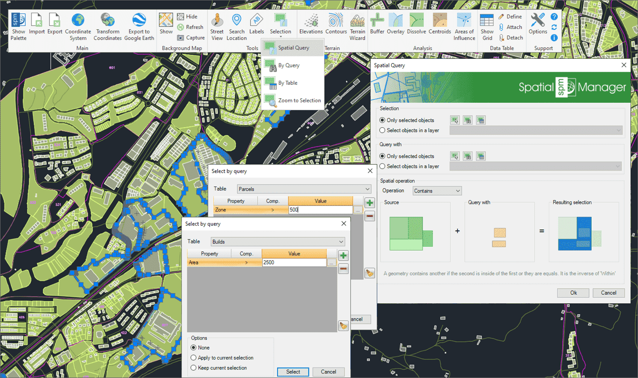
Verwenden Sie Abfragen, um Zeichnungsobjekte basierend auf Attributbedingungen auszuwählen
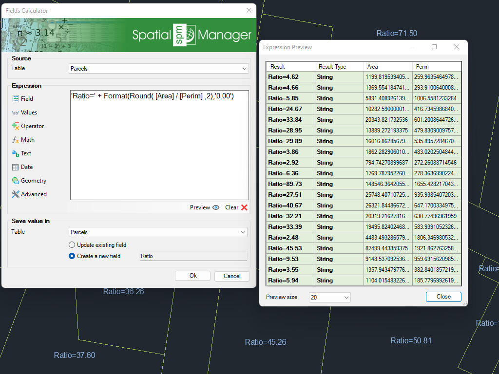
Berechnung in GstarCAD einfacher oder komplexer Ausdrücke mit Hilfe von Operatoren und Funktionen, die auf Feldwerte in einer Tabelle und/oder auf konstante Werte angewendet werden können
* Nur in der Professional Edition verfügbar
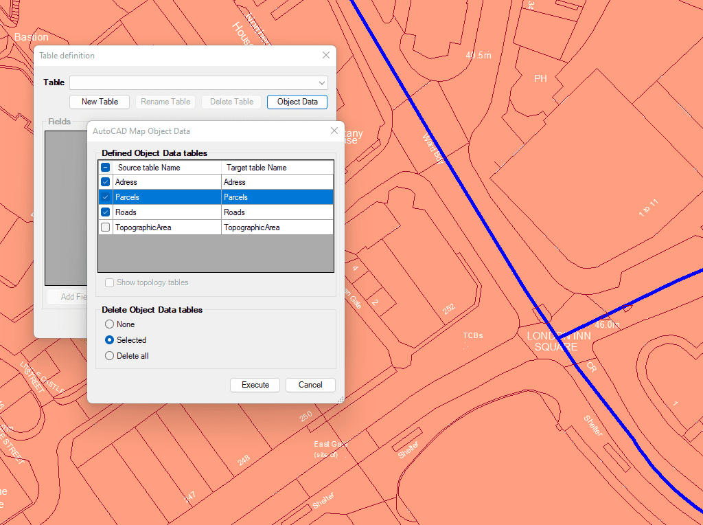
Importieren und konvertieren Sie Daten aus dem AutoCAD Map Format in GstarCAD Extended Entity Data (EDD).

Integration mit Ihren eigenen LISP-Funktionen unter Verwendung der API (Application Programming Interface) zur Erstellung benutzerdefinierter datenbezogener Operationen
* Nur in der Professional Edition verfügbar

Generates a CAD table directly in the drawing using the data linked to the objects. Users can define which fields will appear as columns, making the table highly customizable. In... more

Multiple tables with various fields can be simultaneously attached to objects. This capability offers a highly organized and structured method for managing data. This approach allows the use of multiple... more

Reverse geocoding is the process of converting geographic coordinates (latitude and longitude) into a human-readable address or place name. This is typically done using a reverse geocoding service or API,... more

GML (Geography Markup Language) is an XML-based language created by the Open Geospatial Consortium (OGC) for modeling, transporting, and storing geographic information. GML files classify elements by type, and Spatial... more