Inserir legenda no desenho em ZWCAD
Nova em V10Insira uma legenda de mapa temático diretamente no desenho, facilitando a interpretação e comunicação do significado dos estilos aplicados. A legenda reflete as categorias ou faixas de valores usadas na apresentação do mapa
Inserir legenda no desenho
A legenda é gerada dinamicamente e mostra as categorias ou intervalos de valores aplicados, ajudando os usuários a interpretar visualmente os dados.
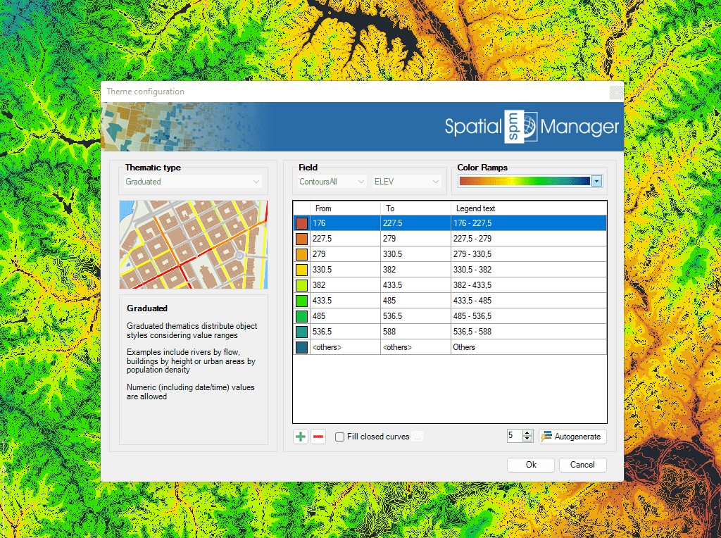
Os mapas temáticos são criados automaticamente com base nos valores de campo. Utilize os valores ou intervalos fixos existentes para definir o tipo temático
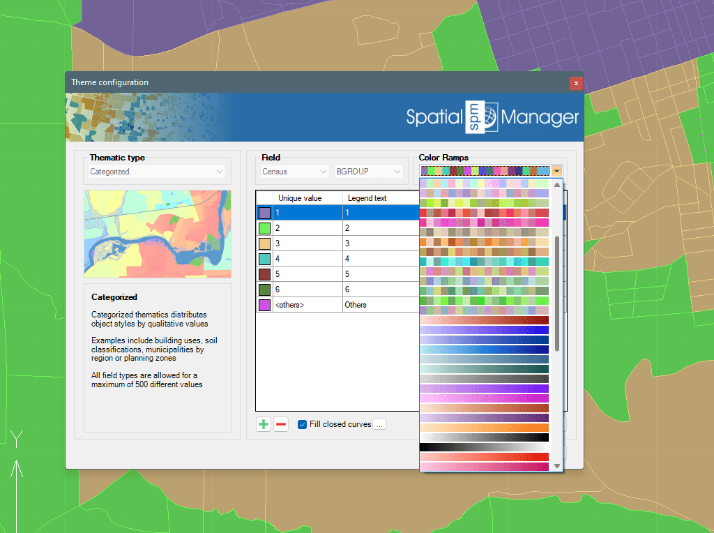
Crie seu próprio conjunto de regras ou selecione um estilo pré-definido. Os esquemas de cores e rampas de gradientes mais comuns já estão incorporados.
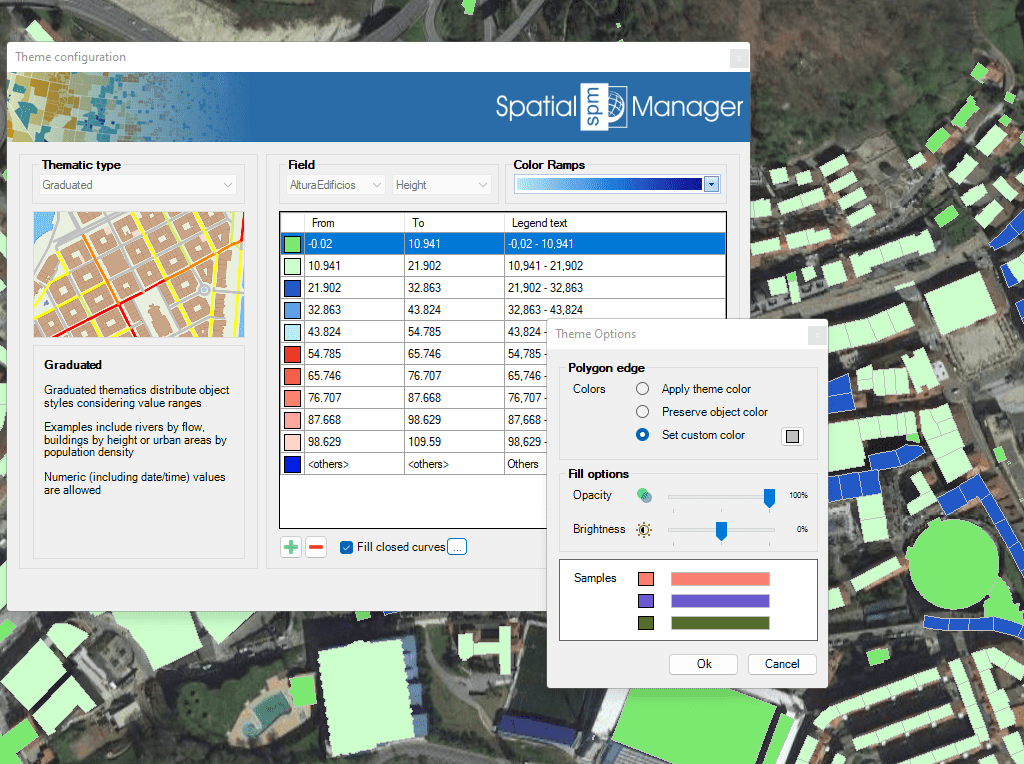
Para melhorar a visualização e identificação de objetos sobrepostos, os objetos fechados podem ser preenchidos com sombreados
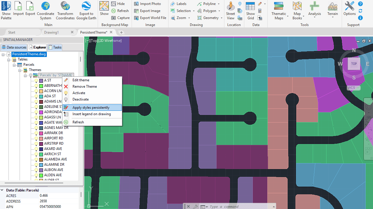
Mapas temáticos e estilos persistentes
Nova em V10Uma vez definido um mapa temático, você pode aplicar o estilo escolhido de forma persistente em todo o seu desenho DWG.

Inserts a thematic map legend directly into the drawing, making it easier to interpret and communicate the meaning of the applied styles. The legend represents the categories or value ranges... more

Thematic Maps allow you to view objects colored by their data values, and you can also apply these styles persistently to the objects, causing these colors to override the DWG... more

Mapflow is a cutting-edge geospatial intelligence platform leveraging artificial intelligence to automatically identify and classify geographic objects–such as buildings, roads, and forested areas–within satellite and aerial imagery. Mapflow enables high-precision... more

Visualize objects by coloring them based on their field values. Different thematic styles can be applied, using either fixed field values (categorized) or value ranges (graduated). Choose from predefined color... more