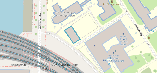
How to import elements directly from OpenStreetMap to AutoCAD
Import your OpenStreetMap data into AutoCAD through a clear and structured procedure with Spatial Manager for AutoCAD.
How to Import OpenStreetMap Data into AutoCAD using Spatial Manager for AutoCAD
If you haven’t installed Spatial Manager for AutoCAD yet, you can begin a free trial here. If you’re already a user, be sure to update to the latest version.
1. Open OpenStreetMap website and define the area to export
- Open the OpenStreetMap website at www.openstreetmap.org.
- Navigate to the area you want to export using the search bar or by manually zooming and panning the map.
- Click on the “Export” button located at the top of the page.
- If there are too many elements in the selected area (usually 50000 nodes), you may need to adjust the bounding box by dragging the corners or selecting a smaller area.
- Once you have defined the area, click on the “Export” button again to download the data in OSM XML format (.osm file).
2. Import OSM downloaded data into AutoCAD
- The import process can be started from Spatial Manager main palette (SPM command) or by clicking Import in the Spatial Manager ribbon tab corresponding to the SPMIMPORT command.
3. Select feature types to import and additional options
- The OSM files are organized by feature types (buildings, roads, railways, etc.). In the import dialog, you can select which feature types you want to import into AutoCAD.
- On the next step, some additional options can be selected, such as layers distributed by a field value and some other advanced configuration.
4. Transform coordinate reference system
- OpenStreetMap data is in the WGS 84 coordinate system (EPSG:4326). Usually, you will want to transform the data to a projected coordinate reference system. In the coordinate system selection step, choose the appropriate for your project. It will be selected automatically if the drawing has a defined coordinate system.
5. Review imported data
- The imported geometries have attached the OSM attributes as extended data (EED). You can review and manage this data using the Spatial Manager palette (SPM command) or in a grid (SPMDATATABLEGRID command).
6. Import other feature types
- Optionally, you can repeat the import process to bring in other feature types from the same OSM file.
7. Review created layers
- The drawing is organized in layers according to the feature types imported and the selected options.
8. Also integrate with OpenStreetMap maps
- Using the SPMBGMAPSHOWCOMMAND command, you can add OpenStreetMap maps as background maps in your drawings.
- Also other map and imagery providers are available, you can use predefined (Google Maps, USGS, ArcGIS, …) or define your custom (WMS/WMTS services).
What versions and editions of AutoCAD are compatible?
All versions from AutoCAD 2013 are compatible and also other vertical Autodesk products like Autodesk Civil 3D or AutoCAD Map 3D. As soon as Autodesk releases a new version, an updated version of Spatial Manager for AutoCAD will be ready to ensure compatibility from day-one.


