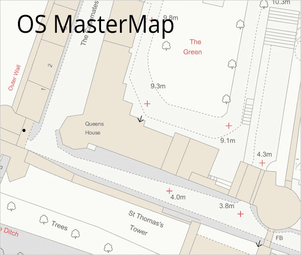
Please, watch the videos of these “Ordnance Survey in ZWCAD” examples:
Video 1: OS MasterMap
Video 2: OS background image maps
Ordnance Survey: Britain’s mapping agency
Ordnance Survey has moved from simply being the producer of the world-famous paper maps to producing quality digital map data, online route planning and sharing services, plus many other location-based products for the United Kingdom users
Its geographic data is so vast, yet at the same time so granular and accurate, that they have mapped the location of every fixed physical object in Great Britain, from the ground upwards, to within an accuracy of one meter. In addition, they have a team of around 300 surveyors and two aircraft that produce 10,000 updates to its system a day – to their OS MasterMap database
Ordnance Survey in ZWCAD
‘Spatial Manager for ZWCAD’ provides the smoothest way to profit from the Ordnance Survey data in ZWCAD. This awesome application includes a powerful GML data provider that has several import parameters and options designed to consider the possiibilities of the huge vector data model that a technical user can get from the main OS vector product: OS MasterMap
On the other hand, ‘Spatial Manager for ZWCAD’ also brings to the user a powerful and easy to use Background Maps technology and access to the Ordnance Survey Image maps products. This functionality automatically selects the ‘Background Map images’ (tiles) to download and display depending on the drawing view. The ’tiles’ are automatically updated when the view is modified by zooms, pans, etc.
The use of the OS image maps with ‘Spatial Manager for ZWCAD’ allows the technicians to not only get more attractive drawings but also to provide them with an unmatched tool for checking, geo-spatial comparisons, etc.


