Tabela de dados em GstarCAD
Melhorada em V10As tabelas de dados fornecem a estrutura para associar informações a objetos do desenho. Elas podem ser anexadas automaticamente durante a importação ou criadas manualmente adicionando campos de vários tipos de dados.
Descubra todo o potencial deste conjunto de ferramentas criado para aprimorar a integração e a edição de dados GIS dentro do GstarCAD.
Estruturas de dados
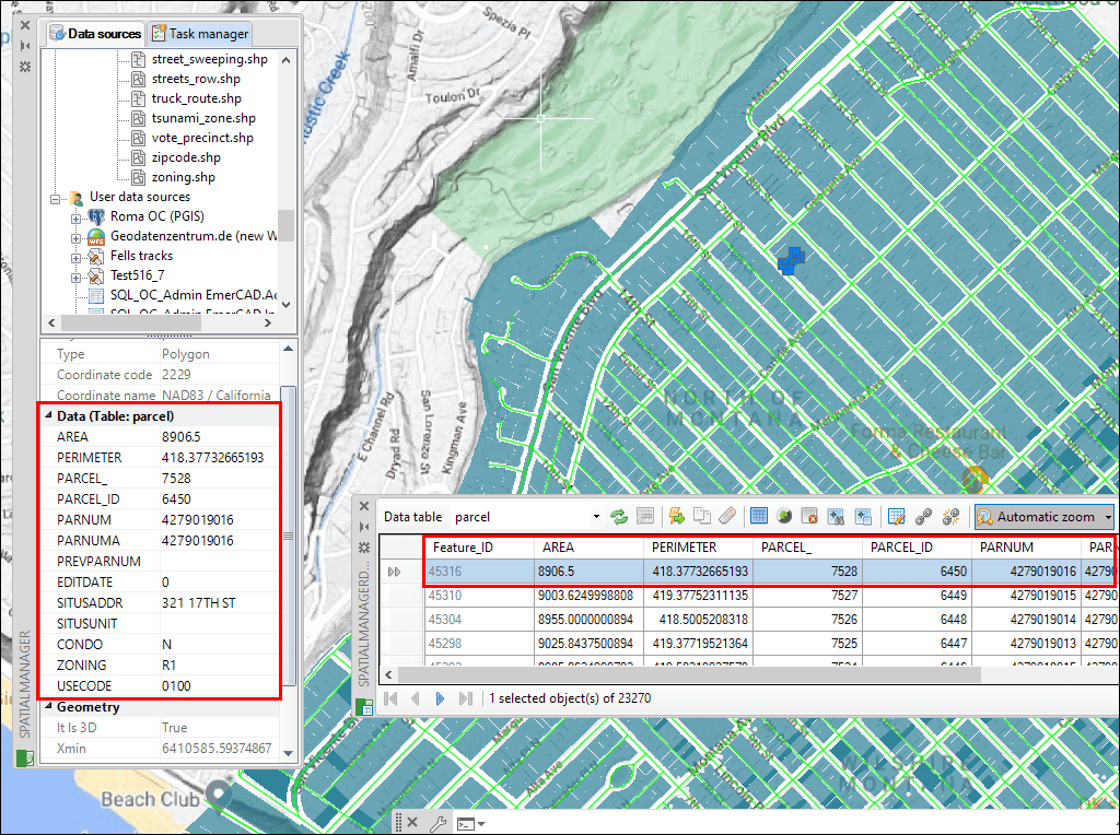
Edição de tabelas

Administração de objetos

Vinculação de várias tabelas
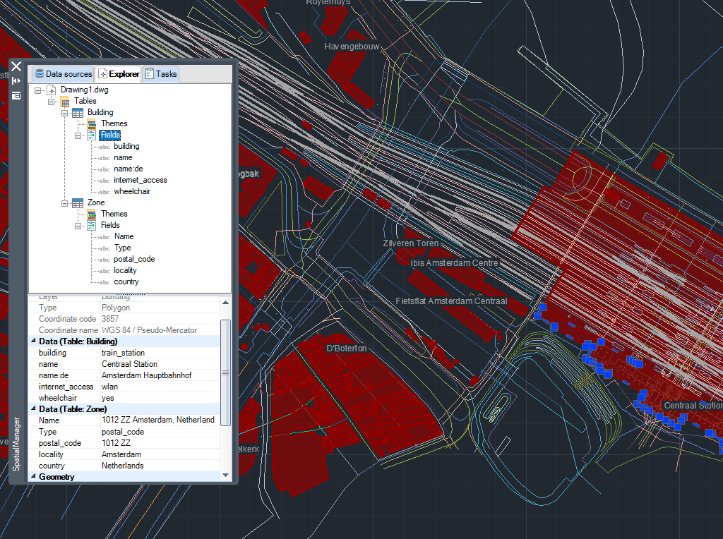
Desenhar tabela
Nova em V10* Só estão disponível na ediçõe Professional

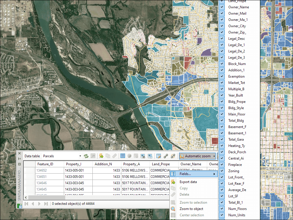
A paleta da Grade de Dados em GstarCAD permite visualizar, editar, etc. os dados dos objetos em qualquer tabela do desenho. Também é possível selecionar objetos a partir da Grade de Dados, exportar dados de tabelas, etc.
* Só estão disponível na ediçõe Professional
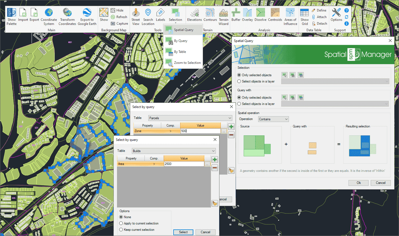
Use consultas para selecionar objetos do desenho com base em condições de atributos
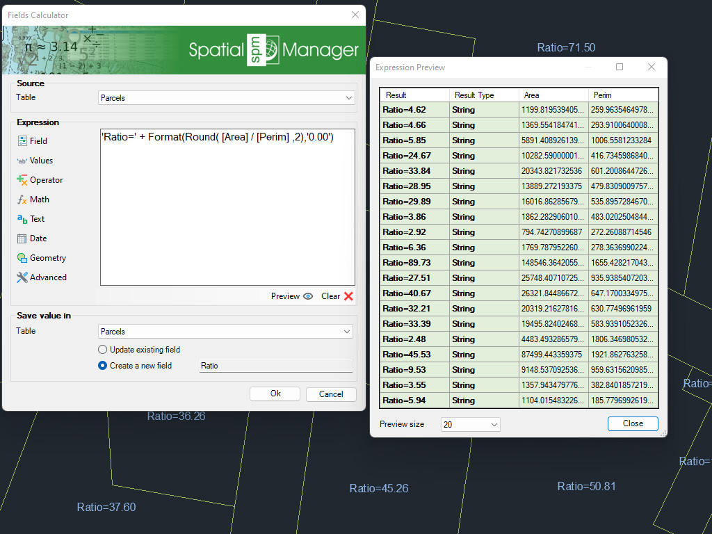
Calcule em GstarCAD expressões simples ou complexas usando operadores e funções que podem ser aplicadas a valores de campo de tabela e/ou valores constantes
* Só estão disponível na ediçõe Professional
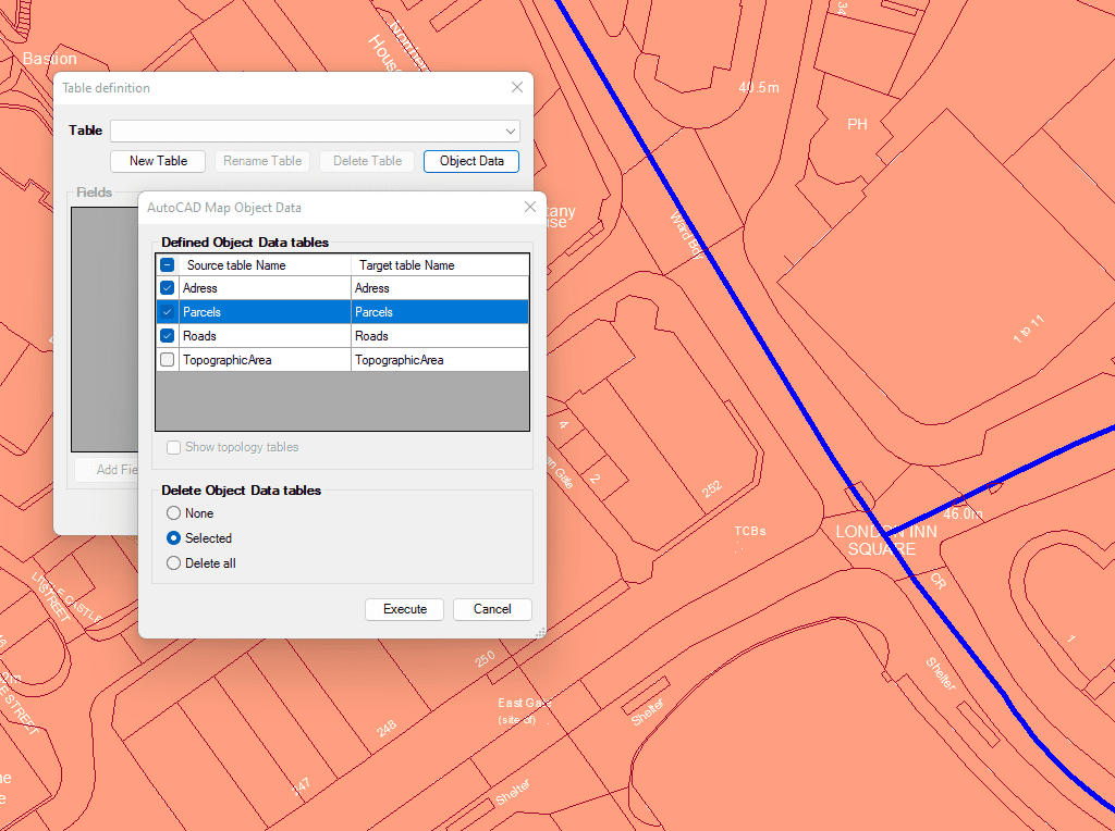
Importe e converta dados do formato AutoCAD Map para Dados Ampliados das Entidades (EDD) do GstarCAD.

Integrar com as suas próprias funções LISP utilizando a API (Application Programming Interface) criando operações personalizadas relacionadas com dados
* Só estão disponível na ediçõe Professional

Generates a CAD table directly in the drawing using the data linked to the objects. Users can define which fields will appear as columns, making the table highly customizable. In... more

Multiple tables with various fields can be simultaneously attached to objects. This capability offers a highly organized and structured method for managing data. This approach allows the use of multiple... more

Reverse geocoding is the process of converting geographic coordinates (latitude and longitude) into a human-readable address or place name. This is typically done using a reverse geocoding service or API,... more

GML (Geography Markup Language) is an XML-based language created by the Open Geospatial Consortium (OGC) for modeling, transporting, and storing geographic information. GML files classify elements by type, and Spatial... more