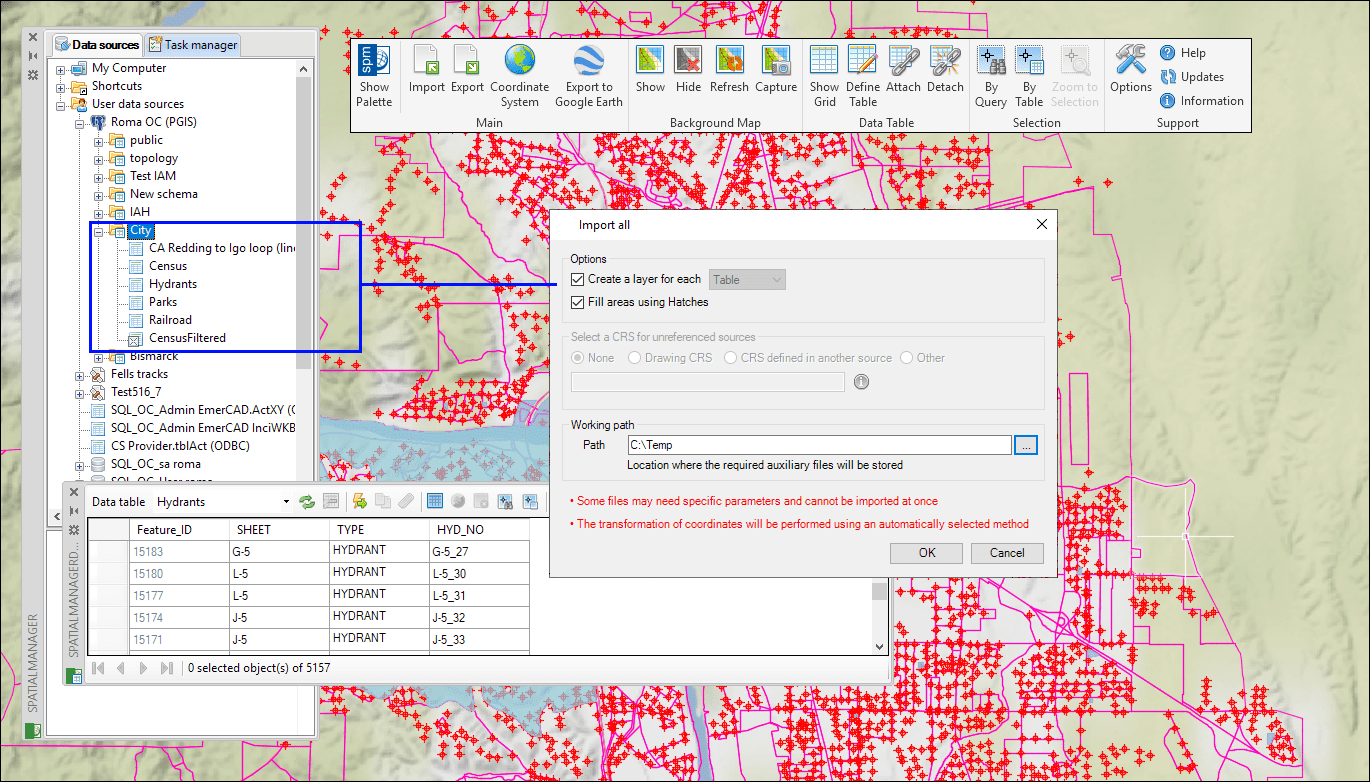
Up to now, ‘Spatial Manager’ (CAD versions) had a powerful tool to import in a single-click operation any supported geospatial file from within a folder. Now you can apply the same tool to all tables inside a schema or multi-table file
Related videos: AutoCAD / BricsCAD / ZWCAD
One-click Import-All from any spatial source: Folders, Schemas or Multi-Table files
Most spatial geospatial and GIS data sources are composed of a lot of information subdivided by means of a structured or unstructured data organization. Thus, it is common to find how many different types of files (Shapefiles, KML/KMZ, GPX, GML, etc.) or tables within database schemas (PostGIS, SQL Server Spatial, etc.) shape a cartography or GIS including geometries and data
That is the main reason why it is so useful a tool that allows you to import in your drawings all geospatial information from any multiple container in a comfortable and quick process
As you can see in some previous Blog entries, you could so far easily do it for simple data files (Shapefiles, GML, Raster, etc.) that were stored inside a folder. Starting from the version 5.2, you can run the same right-click task over all tables included in a database schema (or multischema file, such as SDF), and also inside a complex file (SQLite, GPX, etc.)
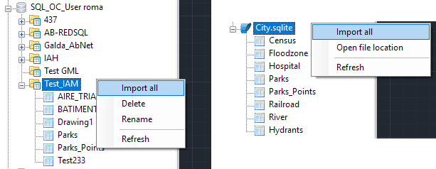
Samples: Importing-All from a SQL Server Schema and from a SQLite multi-table file
The above videos will show you three “Import-All” samples and how to proceed in various cases
Learn more about ‘Spatial Manager’ data sources’:


