Although since the first versions of ‘Spatial Manager’ has been possible to access WFS (Web Feature Service) servers, until now this has been done through two data providers based on FDO and OGR. Recently, a native WFS data provider has been added in the application, offering more advantages and features
Related videos: AutoCAD / BricsCAD / ZWCAD / Desktop
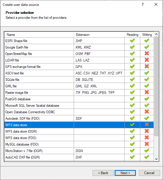
Accessing a WFS data store through the new data provider is done by setting up a User Data Source (UDS) using the corresponding ‘Spatial Manager’ wizard. The new data provider is based on reading GML (Geographic Markup Language) data, which is the data structure used by WFS servers, and the two previous ones (FDO and OGR) have been kept for compatibility with UDSs already defined by the users
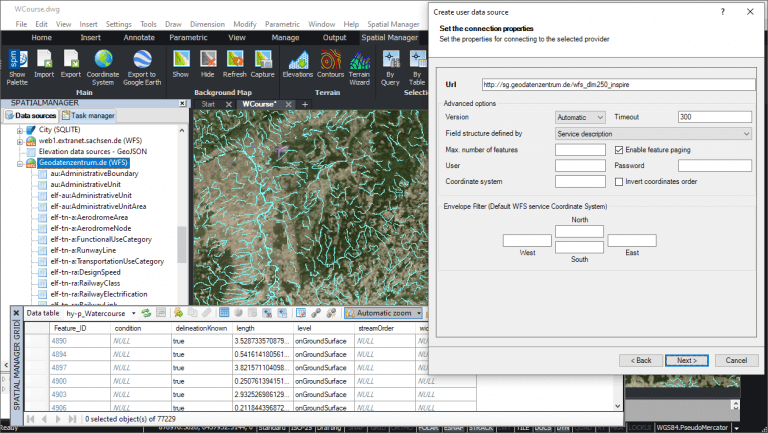
In the next wizard step you will define the connection parameters for this new provider, which are more extensive than those of the existing FDO or OGR providers. The following image show you the parameters window of the new data provider and, below, you can find the description about those parameters
- Url: WFS server URL
- Version: WFS version. Usually you can leave this value as “Automatic”
- Timeout: Server waiting time for requests (in seconds)
- Field structure defined by: Field structure source
- Service description: WFS service publishes which fields are included in a table
- First element (uniform tables): In some cases the WFS service does not indicate in its description which data fields are included in a table, or it publishes fields that are not really used. This option is recommended for tables whose features all have the same fields, assuming they are those of the first feature read
- Max. number of features: Maximum number of features to read. Can be useful for testing in big tables in order to get a sample data reduced set
- Enable feature paging: Reading of features is done by blocks instead of all of them in a single request, allowing to show the progress of reading
- User and password: If required by the service
- Coordinate system: Coordinate system code to be used in the requests to the service. If an invalid value is introduced, the service default coordinate system will be used
- Invert coordinates order: Some WFS services return the coordinates reversed. Activate this option in order to swap XY coordinates
- Envelope Filter (Default WFS service Coordinate System): This allows you to filter the reading of features by area. It is a rectangular limit of the area to be consulted. The entered coordinates must be in the service default coordinate system. This is not affected by the setting of the “Coordinate system” option detailed above
In order to show the setup and functionality of this new data provider we have chosen a WFS server including data published by the German “Bundesamt für Kartographie und Geodäsie” (Geodatenzentrum.de). The data structure on the server also complies with the European INSPIRE directive, which allows spatial information to be homogenised so that it can be shared between different applications and user profiles
Sample WFS server URL (copy & paste when need it):
http://sg.geodatenzentrum.de/wfs_dlm250_inspire
As you will see in the above videos, once the USD has been defined for this WFS server (USD data and parameters are always stored for future processes), you can expand the included data tables in order to load/import any of them through the usual ‘Spatial Manager’ import wizard and apply any of its options and parameters
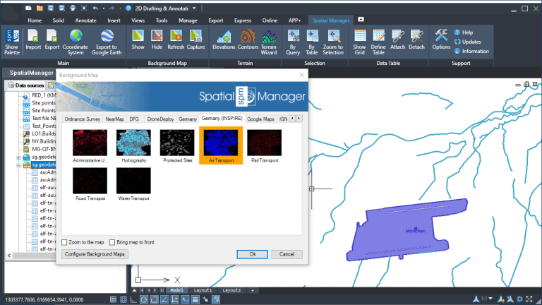
Taking advantage of the fact that this same service also publishes information from image map servers in WMS (Web Map Service) format, in the same example we have defined a user Background Map including the necessary parameters to access the layers of the WMS server. Thus, it is possible to analyze how we can combine vector information from a WFS server and the corresponding raster information included in the parallel WMS server
Sample WMS server URL (copy & paste when need it):
http://sg.geodatenzentrum.de/wms_dlm250_inspire?request=GetCapabilities&service=wms
Enjoy the videos
Learn more about User Data Sources in the ‘Spatial Manager’ technical Wiki:


